ADS3: Office of Thames Studies
Jump to
Is the Thames a river? Its meanders barely meander. Its tributaries are buried underground. Its banks are largely built up. People cannot swim, or dare to drink, pollution floats around. The Office of Thames Studies (OTS) will investigate England's longest watercourse and rehearse alternative futures for its watershed.
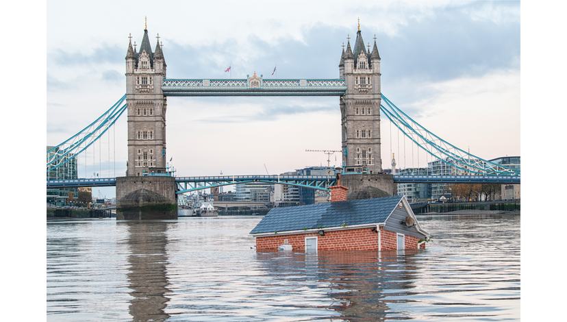
Our House is Flooding. London 10/11/2019. Photo Guy Reece. Courtesy XR.
The OTS will trace the architecture of its transformation through contaminated water and eroding soil, building materials and public health, leakages, brownfields, and legal grey zones. Through fieldwork, collective research, and public engagement, the OTS will follow the lived experience of the river to examine how this space is inhabited, governed, polluted, financialised and accessed by humans and more-than-humans. Its constituents range from public beaches, waterfront properties, boat dwellers, the unhoused, and speculative real estate occupants. We live amongst fatbergs, microplastics, drugs and sewage, and contested infrastructures, viewpoints, and building codes. Lawsuits, citizen campaigns, water bill boycotts, and water justice movements all demand different forms of access, stewardship, and accountability. We will investigate the Thames as a vast piece of public infrastructure, examining how the river makes the buildings that make the city that make us. We will study interconnected scales: from bacteria, pharmaceuticals and dredged sediments to bodies, buildings and neighbourhoods; from tributaries and floodplains to estuaries, oceans and planetary extraction. Working across disciplines, communities, and institutions, the Office of Thames Studies will develop spatial propositions, material evidence, models, cartographies, moving image, and acoustic reverberations. This work will allow new relations to the river to be tested, and alternative futures and legal fictions rehearsed in the present.
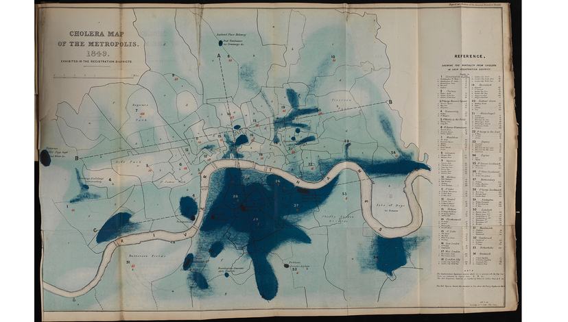
Report of the General Board of Health on the epidemic cholera of 1848 & 1849. Great Britain, 1850. Wellcome Collection.
The Thames has never just carried water. Its docks, warehouses, coffee houses, shipping routes, and insurance companies have underpinned the circulation of enslaved people, colonial commodities, and financial assets, making metropolitan prosperity inseparable from plantation economies, material flows, and extractive territories elsewhere. These dependencies did not disappear with the end of the British Empire. London remains embedded in racial capitalist networks as a financial centre for mining, energy, insurance, and commodity trading operating across countries overseas, indigenous territories, and settler-colonial states. Capital accumulated through distant extraction returns to the Thames through a complex architecture of tax havens, pension funds, offshore ownership, container megaports, and real-estate investment, while climate costs continue to be offset or displaced.
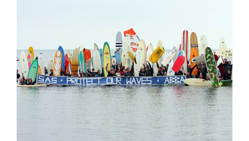
Protect Our Waves Demo, 10/9/2010. Photo Hugo Tagholm. Creative Commons.
The capital’s river is built and layered in all possible directions. It simultaneously operates as public space, inhabitable area, sewer, shipping channel, drinking-water source, property boundary, habitat, workplace, recreational space, flood risk and defence, and an increasingly diminished water commons. Benefits and privilege accumulate along its tidal shores, while environmental and social costs are displaced downstream, offshore, and onto other bodies. Sewage makes this externalisation tangible. Wastewater is an intimate archive: an X-ray of the city that carries traces of what bodies ingest, medicate, metabolise, and discard. Hormones, contraceptives, PrEP, antidepressants, recreational drugs, and other pharmaceuticals bind bodily and environmental metabolisms. Wastewater complicates the boundaries between bodies and ecologies, public and intimate life, purity and contamination, reproductive and non-reproductive futures. What queer understandings of space might emerge from bodies, ecologies and territories that leak and refuse to remain contained?
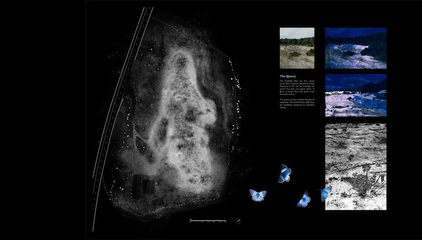
Using chalk reflectivity and LiDAR techniques to restore England’s chalk streams through the eyes of butterflies. Millie Downes, ADS3 2025/26.
Architecture has continually remade the river too through council housing, cultural hubs, civic spaces, and retail complexes: from Thamesmead and Churchill Gardens; to the South Bank Centre and redevelopment of Battersea power station and Tate Modern; to financialised and gentrified waterfronts along the Thames Path; and from Crossness and Beckton sewage works to flood meadows, bird sanctuaries and wetland brownfields. The Thames has long been divided into separate logistical problems of supply, sewage, navigation, flooding, ecology, and property, which has resulted in today’s fragmented landscape of deregulated regulators, useless utilities, and public authorities entangled in private interests. The Thames Barrier, closed 221 times since it opened in 1982, protects the metropolis from tidal flooding. Joseph Bazalgette's Victorian–era sewer network transformed public health by redirecting waste downstream. While the Thames Tideway Tunnel promises relief from an overburdened sewer system, its capacity has already been deemed insufficient even before completion.
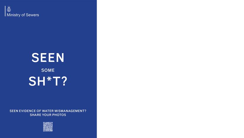
Ministry of Sewers. Cooking Sections, 2025.
At the river's edge, other struggles emerge. Privately controlled waterfronts interrupt public access. Boat dwellers negotiate increasingly valuable waters. Mudlarkers encounter material histories exposed by the tide. Gulls feed on the city’s rubbish. As waterfront land appreciates and slumlords proliferate, housing precarity and encampments are pushed toward the river's residual spaces. Wetlands compete with development. Dredging makes room for ever greater container traffic. Sand and sediment taken from the riverbed and Thames estuary enter the concrete and cement building our homes. Sea-level rise redraws boundaries of property, flood risk zones, and insurance coverage. New water species, whether desired or not, arrive with ship ballast and rising water temperatures.
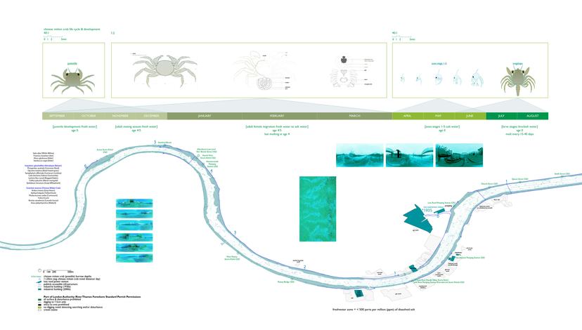
Murky edges along the Thames through the eyes of the new arrivals of mitten crabs. Selina Wong, ADS3 2025/26.
A river welcomes migration, provides water, connects territories. It also unsettles the apparent stability of property and jurisdiction. Its edges move, its waters cross boundaries, its sediments migrate, and its ecologies extend far beyond cadastral lines. Queer, indigenous, and non-normative understandings of territory and fluidity challenge assumptions that land, water, bodies, and species exist as discrete, governable entities. Its banks are engineered, tributaries buried, flows regulated, floodplains built upon, sediments dredged, and access interrupted. At what point do these accumulated demands produce functional exhaustion? Is the Thames still a river? How many contradictions can be imposed upon a stream before its capacity to river is compromised? What if London faced the Thames differently, as a civic infrastructure for housing, recreation, food, transport, biodiversity, and collective life? What is a right to river and who or what can spatially claim it?
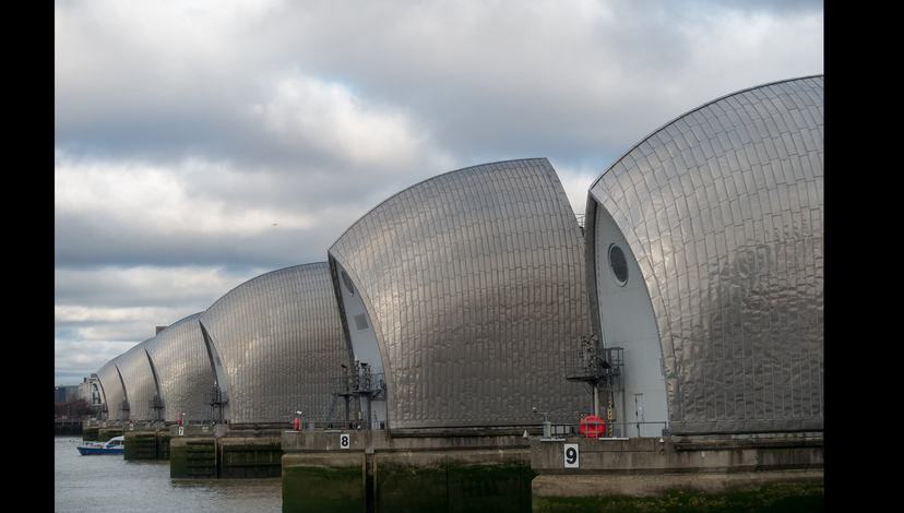
View of the Thames Barrier from Greenwich London, 28/1/2018. Photo Angus McIntyre. Creative Commons.
The OTS will work with residents, civic organisations, scientists, and citizen-science groups who are demanding a safe, clean and accessible river. Its research follows the river and its meanders, tracing ecological and social struggles across its watercourse, catchment, tides, and tributaries to identify where architecture can intervene in existing conflicts and alliances. The Thames River is both site and method: crossing jurisdictions and scales, connecting apparently distant bodies, landscapes and forms of power, and ultimately reimagining disturbance and resistance from the mouth out.